The Biden administration in the United States has urged China not to impede the flow of Mekong river waters to southeastasian countries downstream. Suspicions about the use of transboundary rivers for geopolitical gains was recently highlighted by IndiaNarrative.com when it reported that China had constructed 11 dams over the Mekong, threatening water flows to several ASEAN countries. Besides, China had decided to build a 60-gigawatt mega-dam on the Brahmaputra river, just 30 km away from the Indian border, which could restrict the water flows to India and Bangladesh.
The Mekong is the longest river in the region with a length of approximately 4900 km, flowing from its source on the Tibetan Plateau in China through various Southeast Asian countries. While the Upper Mekong River Basin comprises the Tibetan Plateau, the Three Rivers Area and Lancang Basin in China and Myanmar, the Lower one is made up of the Northern Highlands, the Khorat Plateau, the Tonle Sap Basin and the Mekong Delta. It covers Thailand, Laos, Cambodia and Vietnam.
The Mekong River Commission (MRC) – an intergovernmental organisation for regional dialogue and cooperation in the lower Mekong river basin based on the Mekong Agreement between the four Lower Mekong countries – had reported recently that the water level along the river has fallen to "worrying" levels.
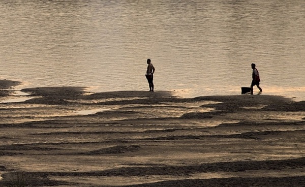
While the region has received lower rainfall since the beginning of the year, the major reasons have been the flow changes made upstream, hydropower operations in the Mekong tributaries and outflow restrictions from the Jinghong hydropower station in China's Yunnan province.
A file Al Jazeera English report on how dying Mekong is threatening livelihoods of millions in several southeast Asian countries
Various agencies have for years reported with evidence that the downstream problems are made worse by the construction and operations of such upstream dams in China.
"There have been sudden rises and falls in water levels immediately downstream of Jinghong and further down to Vientiane, which has been challenging for authorities and communities to prepare for and respond to possible impacts," said Dr Winai Wangpimool, Director of the MRC Secretariat’s Technical Support Division.
The MRC informed that China’s Ministry of Water Resources notified early January that the outflow from Jinghong would be restricted due to the maintenance of power grid transmission lines. The Ministry, however, did not specify the river water level before the outflow restriction nor the volume to be restored. This despite the fact that last year, China had agreed to share year-round water level and rainfall data with the MRC. Under the agreement, Beijing had pledged to notify the MRC and its member countries of any abnormal rise or fall in water levels or discharge, and provide relevant information on factors that might lead to sudden flooding.
River levels in all these countries have remained lower than their long-term averages since early November prompting US to call on China to live up to its commitments and consult with downstream countries.
"For decades, these values have guided our work to promote the health and sustainability of the Mekong River and the nearly 70 million people whose livelihoods depend on it. We share the concerns of Mekong region governments and the Mekong River Commission about the recent rapid fluctuations and worrying drop in Mekong River water levels," said US State Department spokesperson Ned Price.
The United States said that it will continue to support governments and local communities in the Mekong region through the Mekong-US Partnership, including the Mekong Water Data Initiative, the Mekong Dam Monitor, and other tools which put real data in the hands of the people who need it the most.

It is not for the first time that the United States has expressed concern over the plight of tens of millions for whom the Mekong represents life itself and who have been living with the terrible consequences of upper riparian water control.
The Donald Trump administration had brought to fore how China's unilateral manipulation of shared river disrupts the natural flood pulse that replenishes bodies of water like Cambodia’s Tonle Sap Lake, revitalizes the fishing and agricultural industry, and restores freshwater aquifers across the Mekong basin.
"Beijing argues that its dam operations benefit downstream nations by increasing water flows in the dry season. Yet by Beijing’s own admission, these dry-season water releases are done to maximize profit for China’s electricity producers," David Stilwell, the former Assistant Secretary at the Bureau of East Asian and Pacific Affairs in Washington, had said last October during an Indo-Pacific conference on strenghtening transboundary river governance.
While the US, countries of the Mekong region and the MRC have been persisting Beijing to provide more water data, the Chinese Communist Party regime has been accused frequently of not sharing year-round, real-time flow and dam operations’ data.
"Critics say Beijing uses the river as a tap to be turned on or off to meet domestic water requirements. A severe drought in 2019 laid bare the impact that dams in China and in other Mekong countries like Laos have on the river communities. Affected were the rice fields in Vietnam's Mekong Delta as well as Cambodia's Tonle Sap, a giant lake that needs the Mekong's waters for its abundant supply of fish — a staple in the local diet," reported Nikkei Asia Tuesday.
India too, along with the US and other partners like Japan, South Korea and Australia, had been pushing for best practices in the Mekong region. The Narendra Modi government continues to put pressure on China to share respect for international law and rules-based order through the United Nations, ASEAN-led mechanisms and Mekong sub-regional cooperation.
Considering that both the Ganga and the Mekong are civilizational rivers, initiatives like the Mekong-Ganga Cooperation (MGC) launched by six nations – India and five ASEAN countries of Cambodia, Laos, Myanmar, Thailand and Vietnam – aims to facilitate closer contacts among the people inhabiting these two major river basins.


